The main purpose of this ongoing blog will be to track United States extreme or record temperatures related to climate change. Any reports I see of ETs will be listed below the main topic of the day. I’ll refer to extreme or record temperatures as ETs (not extraterrestrials).😉
Main Topic: Cold Weather Pattern To Bring Fire Relief In Colorado, But Exacerbate Fire Potential In California
Dear Diary. In life we see many yin and yang effects in which one good thing may happen that may lead to something bad. For example, a medication that heals sometimes leads to bad side effects. The same will be true in the old weather department late this week, in which several western states will see relief from fires due to cold, snowy weather, but the same system will exacerbate fire potential in California.
Models have been consistent with this forecast, so I have high confidence that the following surface and precipitation pattern will verify:
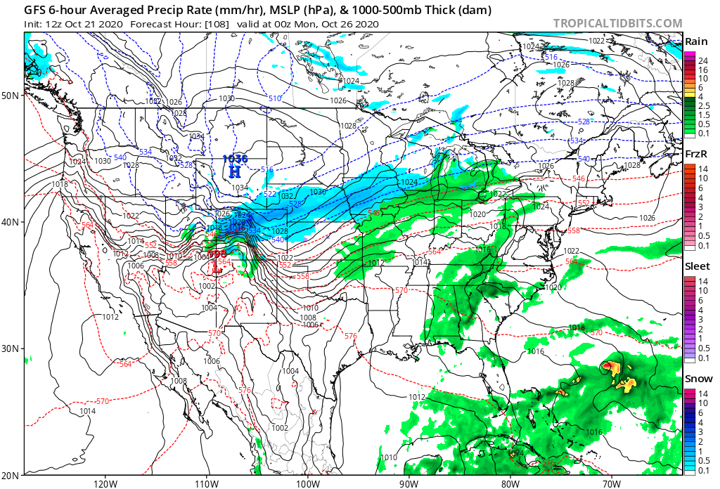
A polar front will finally penetrate into the central Rockies producing widespread snow, which will greatly aid in extinguishing the largest fires in Colorado’s history by Sunday. Before that day, though, high winds ahead of the system may continue to whip up conflagrations. Notice on the above Tropical Tidbits chart high pressure behind the front building into Nevada. Unfortunately this will lead to more dry, gusty Santa Ana and Diablo winds across California. These offshore winds are typical during the fall. That is why fall is the peak of the fire season across California and not the hotter Sumner.
Snow typically comes to Colorado earlier in late September and early October. One sign of climate change is the delay of this snowy cold weather regime.
This coming weather pattern will be particularly cold. Snow will be measured to be over a foot in some areas of the Rockies that had been experiencing near record heat earlier this month.
We are “overdue” for a pattern bringing some record cold to the United States, and this coming weather regime fits that bill. Early next week we will see temperatures that are much more typical for December than October from the Rockies into much of the Midwest:

The above temperature guidance probably won’t be cold enough for much of the Rockies and northern Plains by Tuesday. As usual, I will endeavor to report any record lows that occur next week:
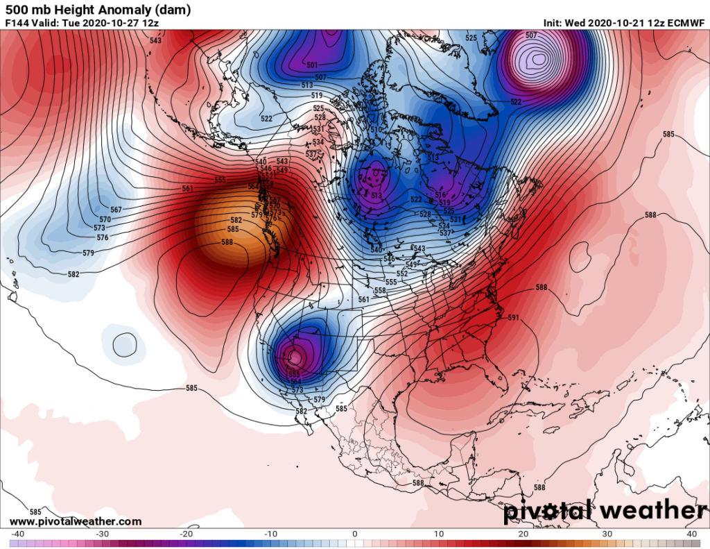
Unfortunately, eventually next week we will probable see a strong upper low forming over the Southwest, the worst possible location for funneling strong Easterly winds across California:
Here is more climate and weather news from Wednesday:
(As usual, this will be a fluid post in which more information gets added during the day as it crosses my radar, crediting all who have put it on-line. Items will be archived on this site for posterity. In most instances click on the pictures of each tweet to see each article. The most noteworthy items will be listed first.)
Now here are some of today’s articles and notes on the horrid COVID-19 pandemic:
(If you like these posts and my work please contribute via the PayPal widget, which has recently been added to this site. Thanks in advance for any support.)
Guy Walton “The Climate Guy”