Monday June 22nd… Dear Diary. The main purpose of this ongoing blog will be to track United States extreme or record temperatures related to climate change. Any reports I see of ETs will be listed below the main topic of the day. I’ll refer to extreme or record temperatures as ETs (not extraterrestrials).😉
Main Topic: Prospects For An Early Summer U.S. Historic Heat Wave
Dear Diary. So far this year the United States has not seen prolonged periods of historic heat over widespread areas. We’ve seen small areas, such as in northern New England last week and portions of the West and Rockies earlier in June with a few days of record if not all-time record heat, but nothing truly widespread and historic. As of today models continue to be in disagreement about prospects for a large heat dome to build east of the Rockies around July 1st. On Friday it appeared that a 594+ decameter ridge was quite possible, which would last more than a week:
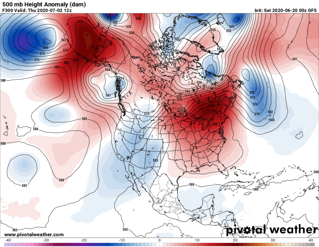
Today we see no such forecast:
This is one reason why A) no operational model should be trusted past 240 hours out and B) ensembles are much better meteorological guidance.
So, what do GFS ensembles valid at 12Z THU 7/2 tell us?

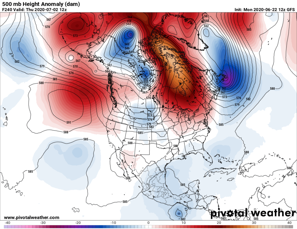
On the above Penn State chart we see a lot of “spaghetti” indicating that operational members of ensemble are in great disagreement. The white line, which represents this morning’s operational forecast valid at 240 hours out, cannot be trusted because it lies well outside of the mean of the rest of the ensemble members on the above graphical depiction. The 12Z MON GFS did not dig the next big system far enough south and west at 240 hours out, which means that both the Canadian model and the following European model is probably better:

Note that the above European model forecasts a big heat wave to begin east of the Rockies as early as Monday or Tuesday of next week as noted by the orientation of our developing ridge. Still, I’m not very impressed with the forecast strength of this ridge, which would need to be well in excess of 594 decameters to get many reports of near record heat.
So as of Monday there remains lower than average confidence that we will see a historic heat wave going into July. Sure there will be some dangerous heat developing east of the Rockies, but we will need to see a few more model runs so that by about Wednesday of this week we can determine how strong any heat dome will get over the country and how long such a ridge will last over the continental U.S.
Here is more climate and weather news from Monday:
(As usual, this will be a fluid post in which more information gets added during the day as it crosses my radar, crediting all who have put it on-line. Items will be archived on this site for posterity. In most instances click on the pictures of each tweet to see each article. The most noteworthy items will be listed first.)
Now here are some of today’s articles and notes on the horrid COVID-19 pandemic:
(If you like these posts and my work please contribute via the PayPal widget, which has recently been added to this site. Thanks in advance for any support.)
Guy Walton “The Climate Guy”