Tuesday November 14th… Dear Diary. Large quantities of both climatic and environmental news come out daily, especially this decade. From time to time I have been highlighting some of the most relevant news pertaining to this web site. Today I am launching a “news corner,” in which I will arbitrarily pick out the biggest news item of the day on my Heat and Cold Diary series. Here is today’s news item:
News Corner: On the 25th anniversary of a major report the Union of Concerted Scientists, of which I am a member, has come out with another ominous message:
https://academic.oup.com/bioscience/article/doi/10.1093/biosci/bix125/4605229
The main takeaway here is that humanity has been given a strong, second notice to get its house in order for its future. Of course as far as the climate goes, that means transitioning to all green energy ASAP.
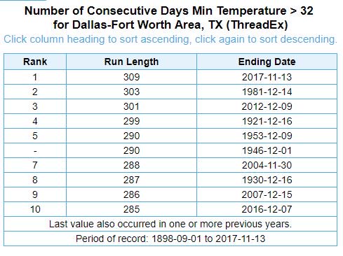
I did see one item this morning indicating yet more proof of a warming climate. Dallas Fort Worth is now tacking on days to the longest period between freezes in their recorded history. They probably won’t see a freeze through the end of November as indicated by Victor Murphy. DFW had a record earliest last freeze on 1/8/17:
As stated yesterday, I’m not that impressed with any potential for record warmth across the U.S. through the end of this week. As far as that next cold wave in the East late this week goes, models are having a difficult time resolving wave dynamic issues. The GFS continues to be much more bullish with the closed low in New England and associated cold air. Today’s European model forecasts the thing to form north of Maine.
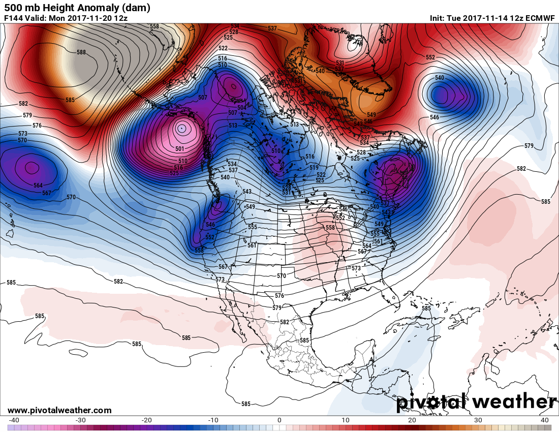
The European model also forecasts a system to break into the ridge in the West, which would not lock in any cold air in the East. I’ll report on which model does the best with the upcoming weather pattern.
I’ll add more to this post as items cross my radar.
The Climate Guy
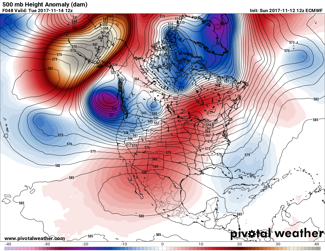
Monday November 13th… Dear Diary. Both some early week near record warmth and late week chill in the Midwest and Northeast are still on tap. Now it is looking like a Southwest ridge, or heat dome, will persist well into next week producing some records in the West and aiding to lock in a cold pattern in the East. Here is what I am seeing from the latest GFS model valid for Sunday morning:
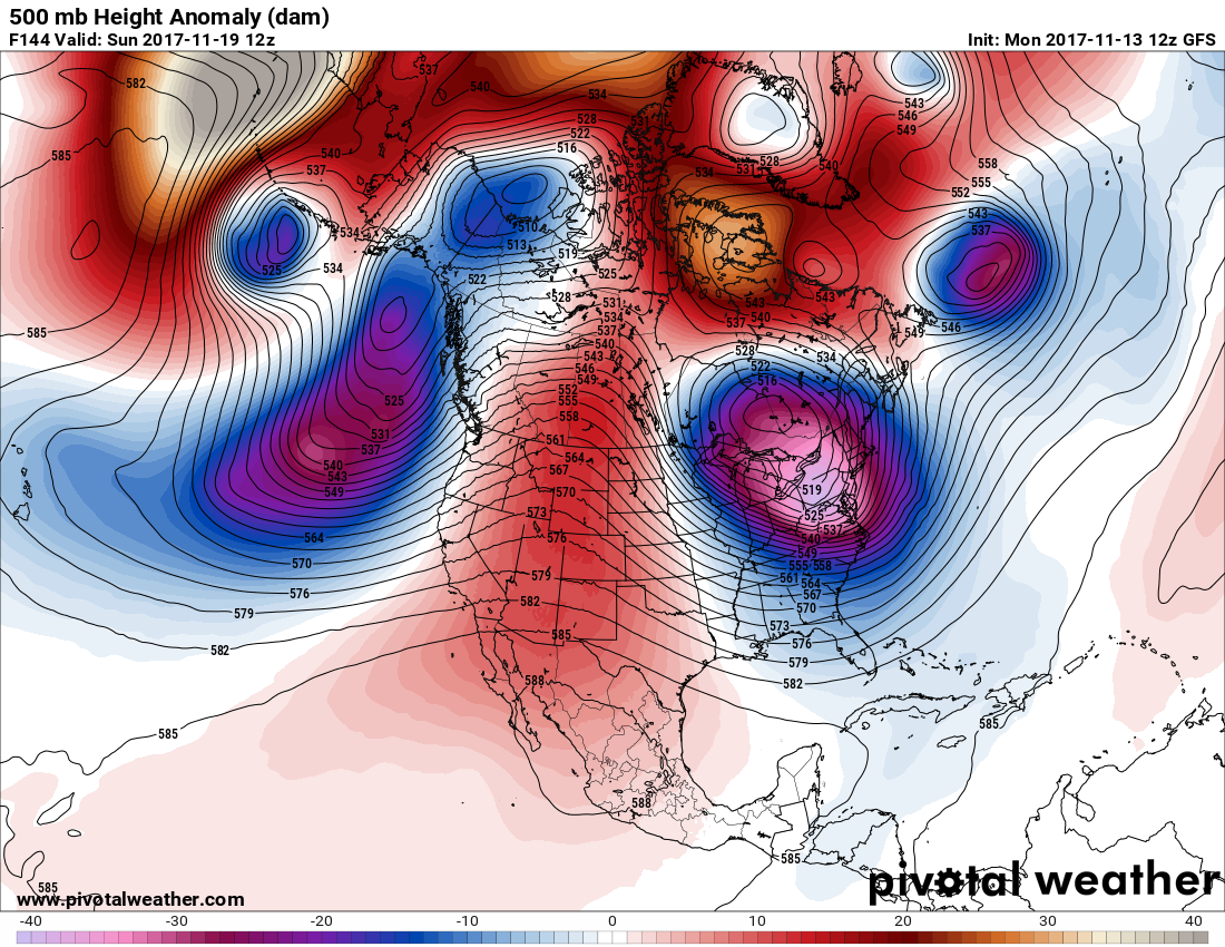
Note that the western ridge is linking up with the positive anomaly north of Hudson Bay. Such a pattern usually holds any cold anomaly over the East trapped in place. The evolution of this pattern will be fascinating as we move towards the Thanksgiving holiday. While cold, we may not necessarily see a snowstorm in the Northeast, but this is something else to keep in mind.
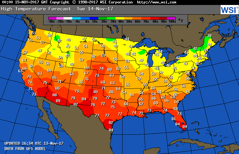
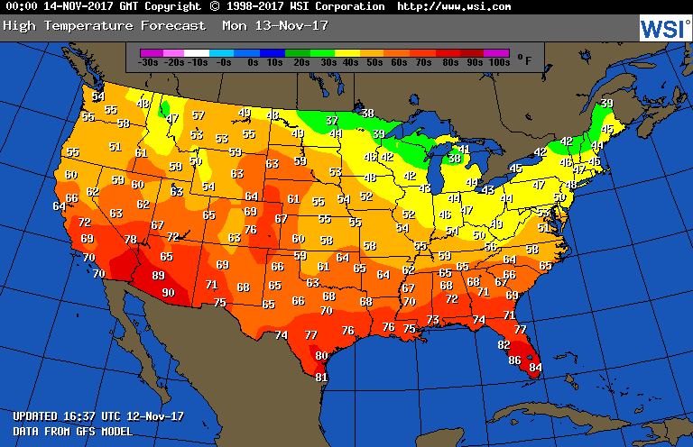
In the meantime tomorrow I do see some potential for daily record highs in the Southwest since Tucson and Phoenix will be close to 90F:
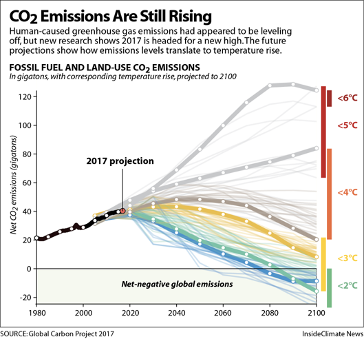
Tisk tisk. I was appalled at seeing news this morning indicating that the rate of atmospheric carbon levels have gone up this year after stabilizing from 2014-2016. For More on that see this new article:
I’ll add to this post if relevant information crosses my radar.
The Climate Guy
Sunday November 12th… Dear Diary. It’s been an impressive, very cold weekend across the Midwest and Northeast with numerous record lows either tied or set. For example, I was surprised to learn that a daily record low had not been at least tied during the month of November at Chicago (O’Hare) since 1991 until now (18F on the tenth tied with 1986). Global warming has definitely skewed the stats towards more record highs, but the synoptic pattern this weekend did add a significant number of record lows to tallies. I’ll be reporting just how many in a few days.
From Zack Labe and Daniel Swain of Weather West: This chart indicates that in the broad scheme of things, the cold air that affected the U.S. pales in comparison to the warmth across the rest of the globe:

There will be another record cold pattern again in the Midwest and Northeast by next weekend. In the meantime we will see significant moderation in temperatures for the bulk of the nation this week. This next warm episode may add to record warm tallies, but not significantly. I did notice that at Phoenix the model forecast of 89F tomorrow comes close to the old daily record high of 91 set in 1999:
By the way, a great, accurate site to quickly look up record temperatures is Threadex:
The 500 mb pattern across the continental U.S. does look warm as noted by the red colors through mid-week except in the Pacific Northwest:
Once we see above average heights build over Greenland (part of the negative phase of the Arctic oscillation) watch out! Another cold, closed low will move over New England probably a week from today:

I’ll add more relevant information to this post if it crosses my radar.
The Climate Guy