Sunday July 19th… Dear Diary. The main purpose of this ongoing blog will be to track United States extreme or record temperatures related to climate change. Any reports I see of ETs will be listed below the main topic of the day. I’ll refer to extreme or record temperatures as ETs (not extraterrestrials).😉
Main Topic: Prolonged Historic U.S. Heat Wave…Update #15: Heat Dome To Have Third Peak On July 25th
Dear Diary. It appears as of this Sunday that this ongoing U.S. heat wave won’t end through the remainder of July. Forecasts models going into August are more than 240 hours out in time, which aren’t that reliable, so we will ignore those for now.
As usual to start this blog let’s access U.S. heat levels for the next two days. Our CAT 2 heat wave from Saturday will continue at about the same level through Monday. As expected heat advisories continue to be added by the National Weather Service across much of the East. A front has brought some relief to the Midwest where most advisories have been dropped from Minnesota through the Great Lakes:
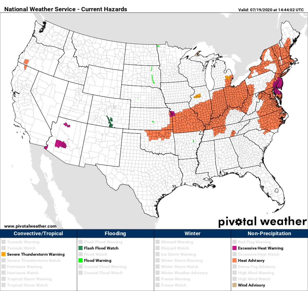
Stifling heat along the East Coast will not be relinquishing on Monday where most of the Megalopolis area should see maximum temperature levels just a few degrees below record values with heat indices around 100°F-105°F:
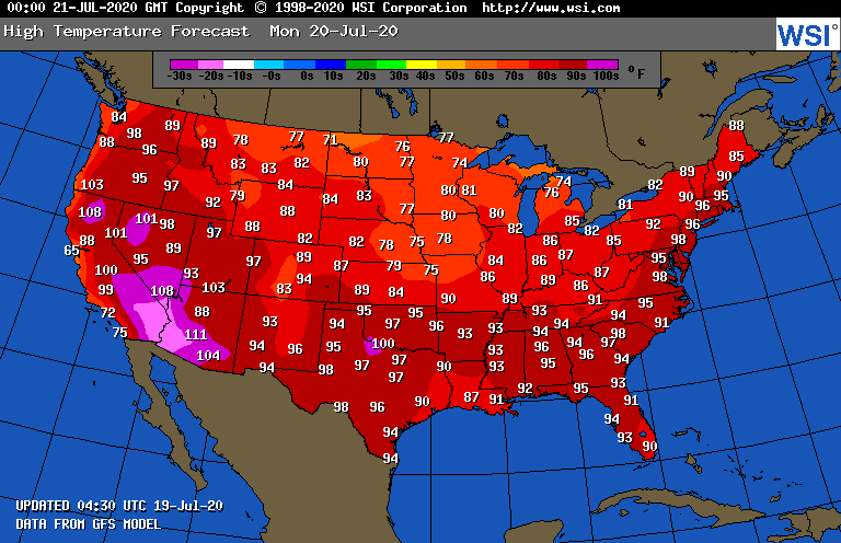
Sweltering temperatures well above 90°F for maxes will persist in the South, where conditions will be similar to those of the Northeast. Heat will also be building across interior portions of the West.
As a reminder please read my post on subjective CAT 1-5 heat wave categorizations. Just like hurricanes we know that heat waves have a beginning, an end, and can wax and wane during their duration:
We may very well see our CAT 2 heat wave develop into a CAT 3 if the heat dome regrows and expands such that a near 597 decameter ridge develops from the southern Midwest states into the mid-South, with the thing not moving for a few days:
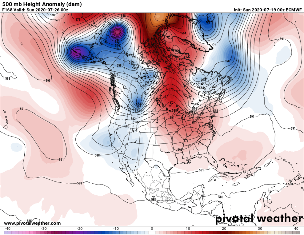
We should also be seeing warm conditions northward through a good chunk of Canada on the 25th, but not quite so much of an area if the above panel verifies compared to older guidance:
As usual, I’ll be posting more updates on this dangerous heat wave as the day progresses.
Here are some “ET’s” from this weekend:
Here is more climate and weather news from Sunday:
(As usual, this will be a fluid post in which more information gets added during the day as it crosses my radar, crediting all who have put it on-line. Items will be archived on this site for posterity. In most instances click on the pictures of each tweet to see each article. The most noteworthy items will be listed first.)
Now here are some of today’s articles and notes on the horrid COVID-19 pandemic:
(If you like these posts and my work please contribute via the PayPal widget, which has recently been added to this site. Thanks in advance for any support.)
Guy Walton… “The Climate Guy”