Tuesday October 29th… Dear Diary. The main purpose of this ongoing blog will be to track United States extreme or record temperatures related to climate change. Any reports I see of ETs will be listed below at the very end of this daily blog. I’ll refer to extreme or record temperatures as ETs (not extraterrestrials).😉
Main Topic: California Continues To Burn In October… New Diablo and Santa Ana Wind Threats For California
I hate to inform all that before the weather situation with California’s current fires get better, offshore winds will strengthen once again, perhaps to historic levels on Wednesday. Though dry weather will continue across the Southwest for the foreseeable future into November, I do see some light at the end of the tunnel with extremely high winds subsiding from Thursday into this weekend as the pressure gradient relaxes from the Great Basin area to the West Coast.
Here is the pressure gradient set up for Wednesday morning across the United States:
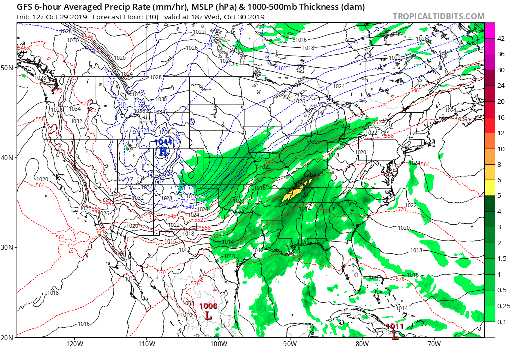
In the above Tropical Tidbits image record setting cold Arctic high pressure of about 1044 millibars is building into Colorado and Utah. Pressure lines (or the gradient) have tightened across California from what they were on this Tuesday, so both high Diablo and Santa Ana winds will be playing havoc with the Kinkade and Getty Fires, respectively through Wednesday.
For northern California:
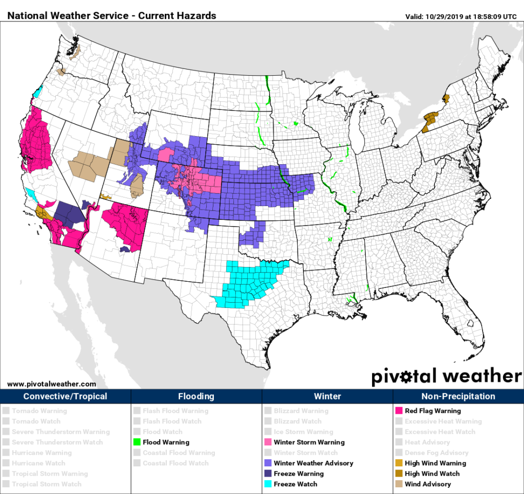
Overall on this NWS advisory map you can see a stark contrast between “fire and ice” within the overall scope of this current “weird and spooky” pattern using Halloween terms:
In a real way, the western end of “Bessie,” the TWC dubbed Rockies and Plains winter storm, will exacerbate conflagrations’ in California. How is that for weather irony?
And:
Let’s pray that fires, especially near the Los Angeles area, don’t grow and strengthen to epic proportions due to this new round of high winds.
Without further ado here are news and notes from Tuesday on California’s high winds and fires. Newest items, as usual, will be listed at the top of this post, which I will update as Tuesday rolls along:
Here is more climate and weather news from Tuesday:
(As usual, this will be a fluid post in which more information gets added during the day as it crosses my radar, crediting all who have put it on-line. Items will be archived on this site for posterity. In most instances click on the pictures of each tweet to see each article.)
Cold “ETs” are starting to come in from the Rockies:
(If you like these posts and my work please contribute via the PayPal widget, which has recently been added to this site. Thanks in advance for any support.)
Guy Walton- “The Climate Guy”