Friday June 14th… Dear Diary. The main purpose of this ongoing blog will be to track United States extreme or record temperatures related to climate change. Any reports I see of ETs will be listed below the main topic of the day. I’ll refer to extreme or record temperatures as ETs (not extraterrestrials).😉
Going From Cool To Extremely Hot? Forecast Possibilities For The U.S.
Of course, on this blog I also report on exceptionally cold, or in the summer cool extremes. This morning was refreshingly cool from the Midwest into the Deep South by early summer standards. In fact, several record lows occurred including this one from Kentucky as shown by National Weather Service reports:
The jet stream around the Northern Hemisphere has gotten very convoluted mainly due to warmth near the Arctic Circle that some have connected to ice loss, and vice a versa, in a horrific feedback loop:
The cold trough that dug over the eastern U.S. yesterday ushering southward some chilly air was meteorologically eye opening:
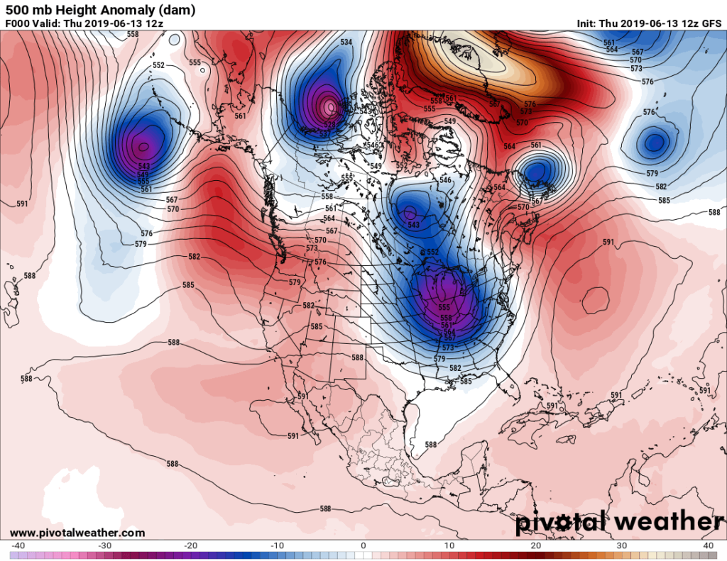
Note above that we have quite the negative North Atlantic Oscillation with very high heights (or warmth) over Greenland, which did aid to force a big cold pocket southward over the Midwest.
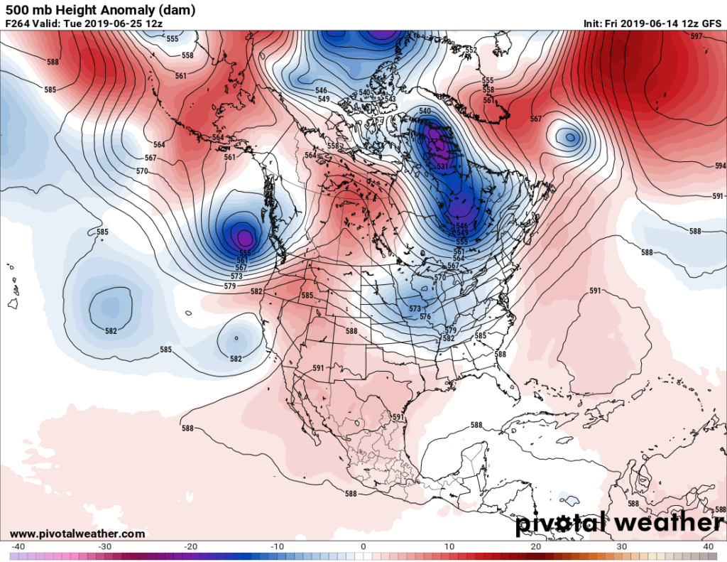
If the new version of the GFS proves more reliable we can look past about 240 hours out for a decent forecast, but I have my doubts. At that time range valid for the week after next operational models have been flipping and flopping on the extent of the next heat dome to affect the United States. This morning’s GFS run has a relatively week system that may carve another trough in the eastern United States:
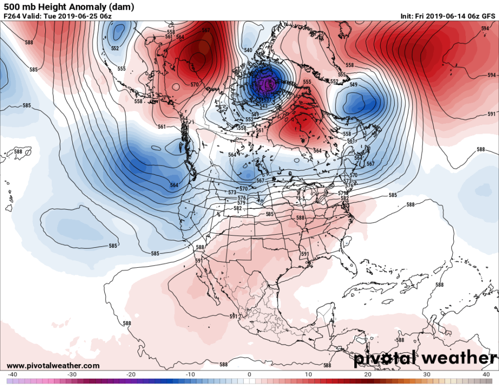
This is the prior GFS model run valid at the same time:
Let’s look at Penn State ensembles to see what may take place around 240 hours out. (Remember that I still consider any models valid past that point to be essentially garbage.):
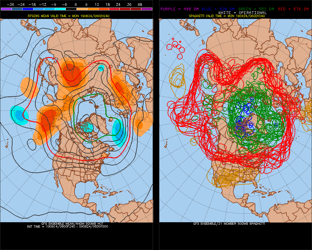
Most ensemble members (as denoted by the brown circles of 594+ decameter heights) anchor the next big ridge either over New Mexico or western Texas, which traditionally would allow for an eastern trough to carve into the U.S. Of course, due to climate change traditional teleconnections are beginning to be less reliable. In met speak teleconnections are climatological wave/trough configurations, or what to expect at 500 millibars around hemispheres.
All this suggests is that their is a huge difference in scenarios ranging from just a heat wave confined to mainly the southwestern U.S. or one ranging from coast to coast and expanding northward as we move into July with the potential for numerous record highs.
I have no doubt that after the next relatively cool, stormy week 500 millibar heights controlling the jet stream will rise, it’s just a matter of where the heat dome’s center will form and how extensive the heat dome will get. Of course, I’ll keep all interested parties updated as new information crosses my radar on this fluid post.
BTW, yes most have been blessed in the U.S. not to see extreme heat so far this year such as in Oklahoma:
Here is more climate and weather news from Friday:
(As usual, this will be a fluid post in which more information gets added during the day as it crosses my radar, crediting all who have put it on-line. Items will be archived on this site for posterity. In most instances click on the pictures of each tweet to see each article.)
(If you like these posts and my work please contribute via the PayPal widget, which has recently been added to this site. Thanks in advance for any support.)
Guy Walton- “The Climate Guy”