Wednesday August 1st… Dear Diary. The main purpose of this ongoing post will be to track United States extreme or record temperatures related to climate change. Any reports I see of ETs will be listed below the main topic of the day. I’ll refer to extreme or record temperatures as ETs (not extraterrestrials)😊. Here is today’s main climate change post related hot topic:
August Heat Targets Europe, California, and Asia
(As usual, this will be a fluid post in which more information gets added during the day as it crosses my radar, crediting all who have put it on-line.)
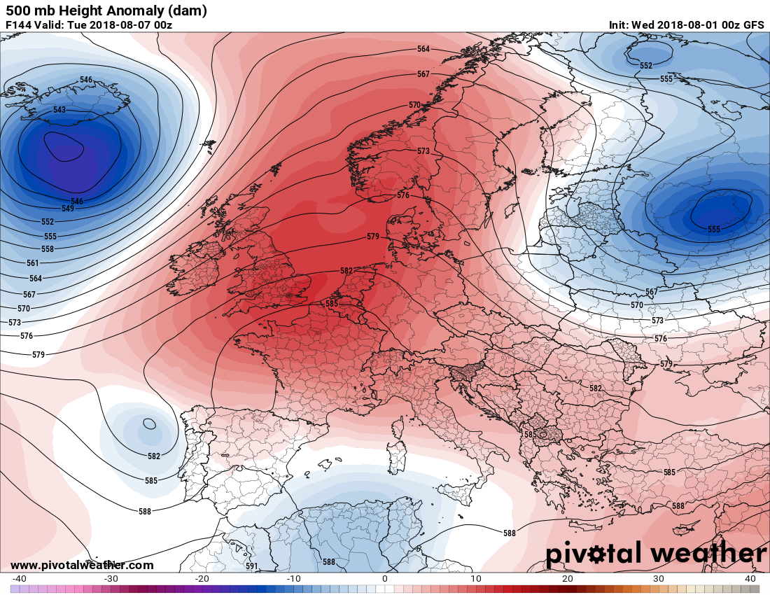
The wild summer of 2018 weather wise has now rolled into August. Unfortunately heat domes responsible for extreme conditions will strengthen the first week of this new month. Let’s take a look using 500 millibar anomaly charts. For those of you unfamiliar with these charts here is a primer:
https://guyonclimate.com/2017/10/02/dissecting-the-heat-dome/
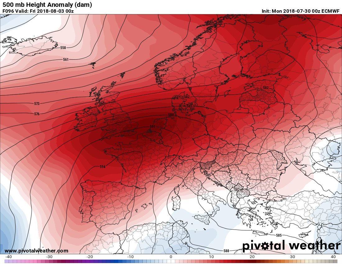
First I noted a few days ago that the monstrous heat wave affecting Europe will probably get more intense in some areas heading into early August:

European model forecasts another blistering heat episode for Europe in early August. @EKMeteo @bhensonweather @MichaelEMann @MikeHudema @MJVentrice @Sustainable2050
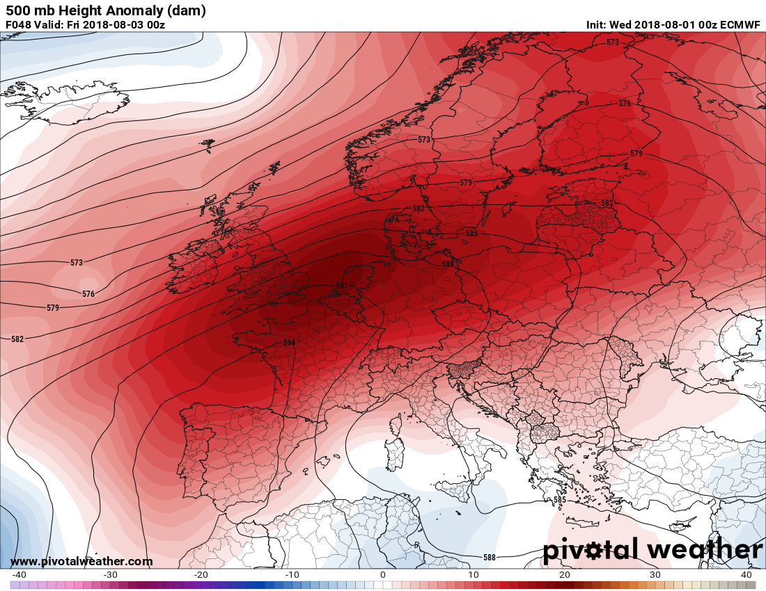
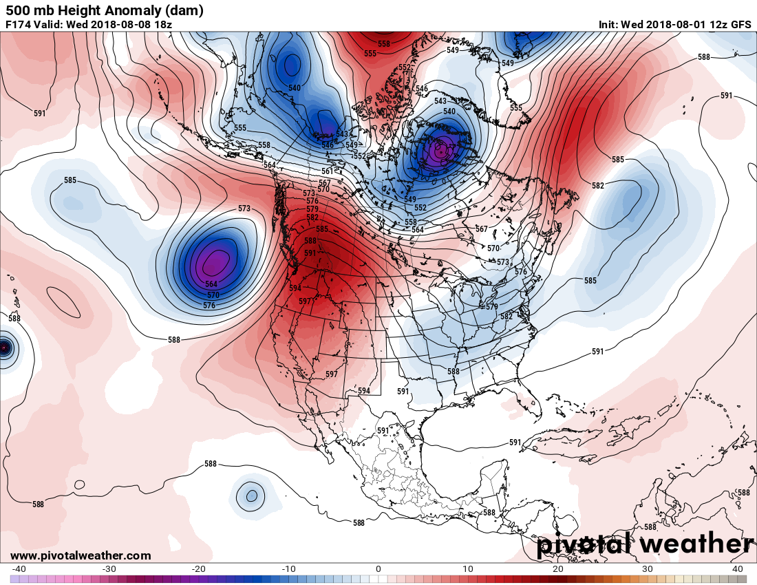
There is not that much discernable change. At 850 millibars we see this:
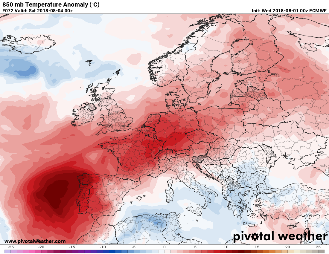
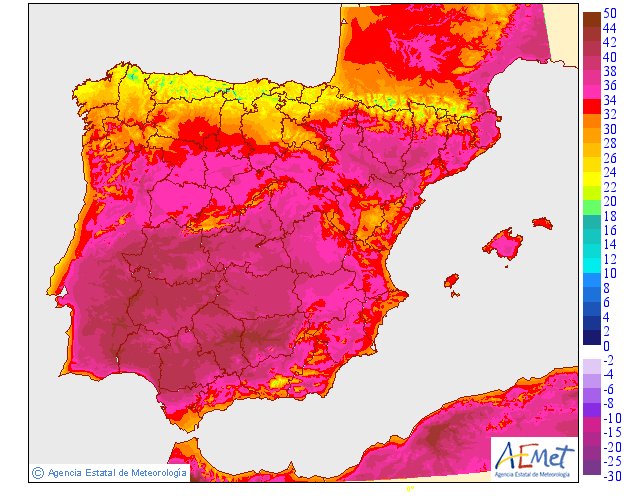
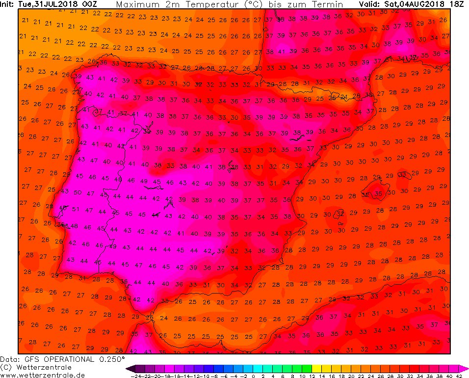
Note the big red spot near Portugal. On Friday 8/3 the worst of the anomalous heat will be in that country where we are expecting thermometers to breach all-time records:

Temperatures could challenge the all-time EUROPEAN record of 48°C (118.4°F) set in Athens, Greece on July 10, 1977
 Kees van der Leun@Sustainable2050
Via @redevries

This is a really worrisome setup for wildfires: temps above 110°F, relative humidity below 20%, and downslope winds.

The Korean peninsula is home to about 75 million people, so this is affecting a lot of folks. Many (most?) in North Korea presumably lack A/C.

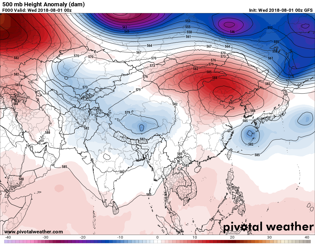
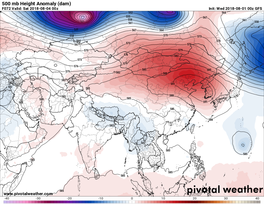

Eek! If anything the heat ridge in far eastern Asia strengthens this week. We’ll see if this translates to more record heat in Korea.
I’ll be reporting any records from these heat domes in the next week.
……………………………………………………………………………………..
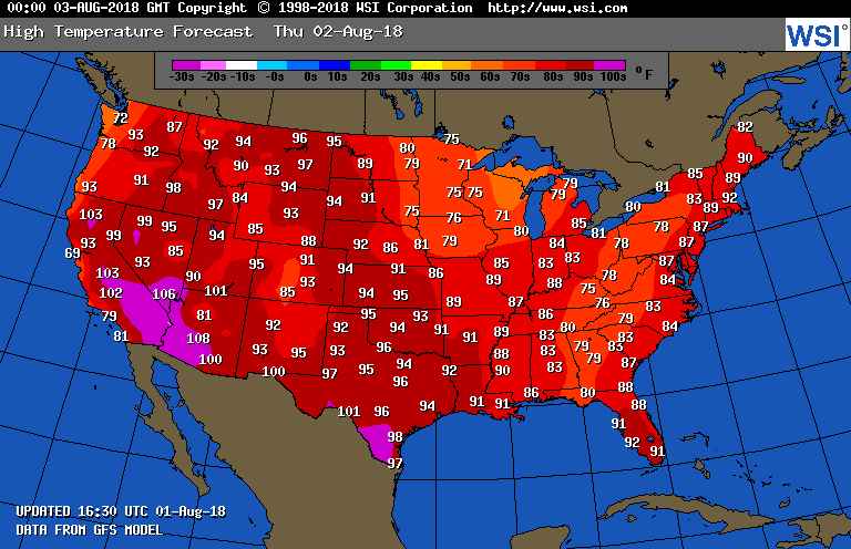
Tomorrow’s forecast max map looks interesting. It may get above 90F in Boston while remaining below 80F in Atlanta due to the “atmospheric river”/trough in place over the East. In the West the cooling trend will continue in the Pacific Northwest while the remainder of the area continues to smolder. A warming trend will continue across the Plains:
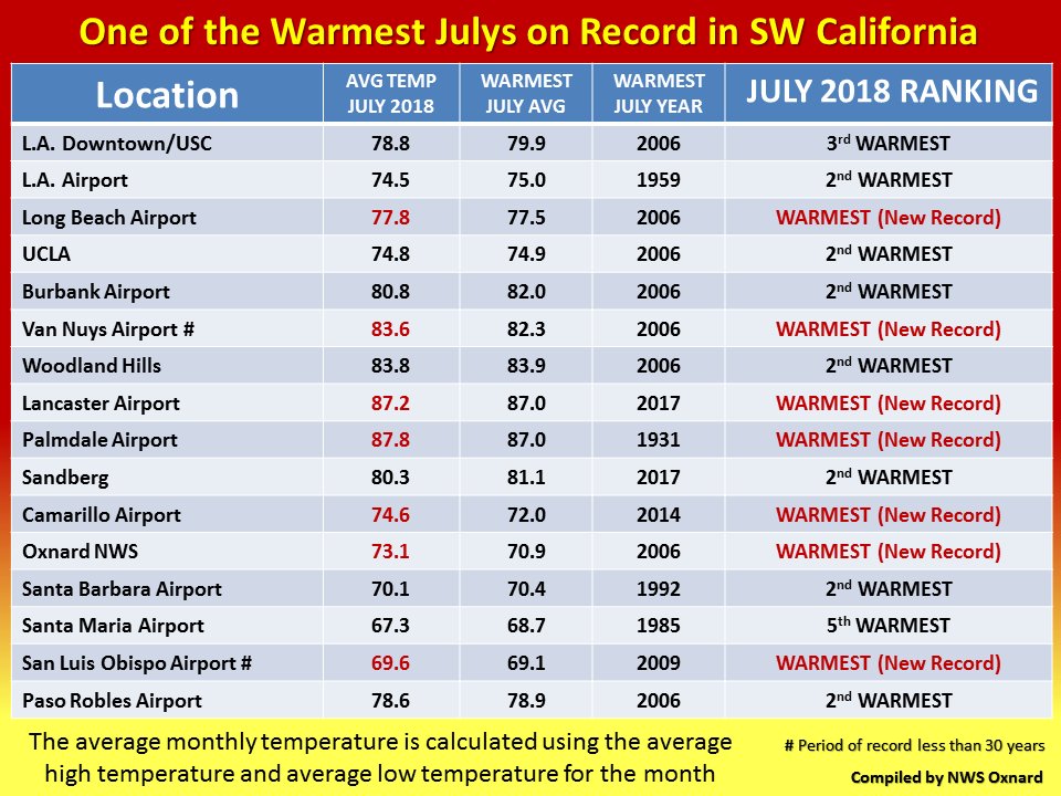
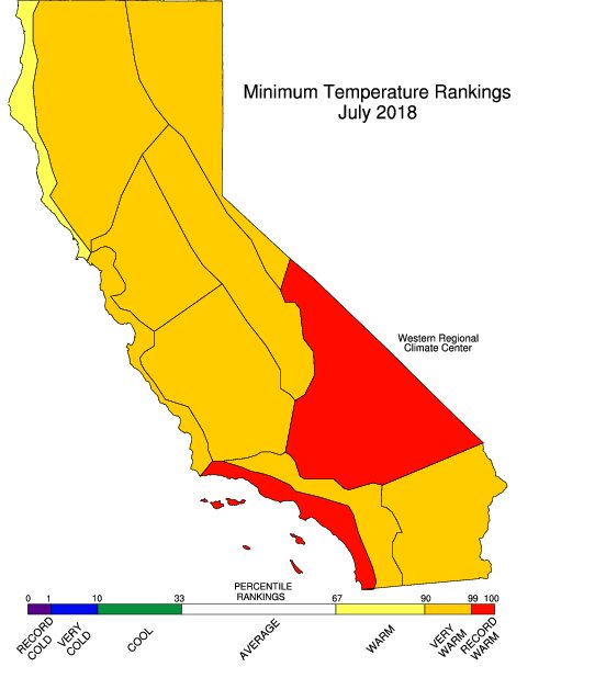
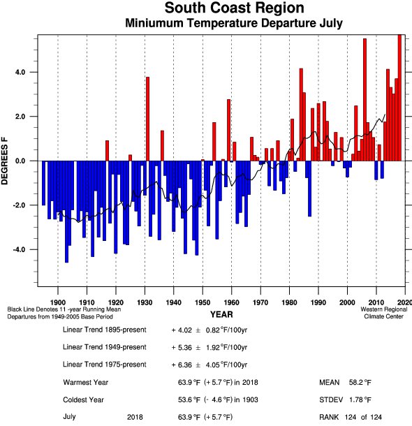
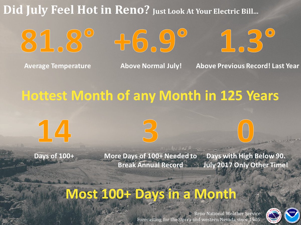
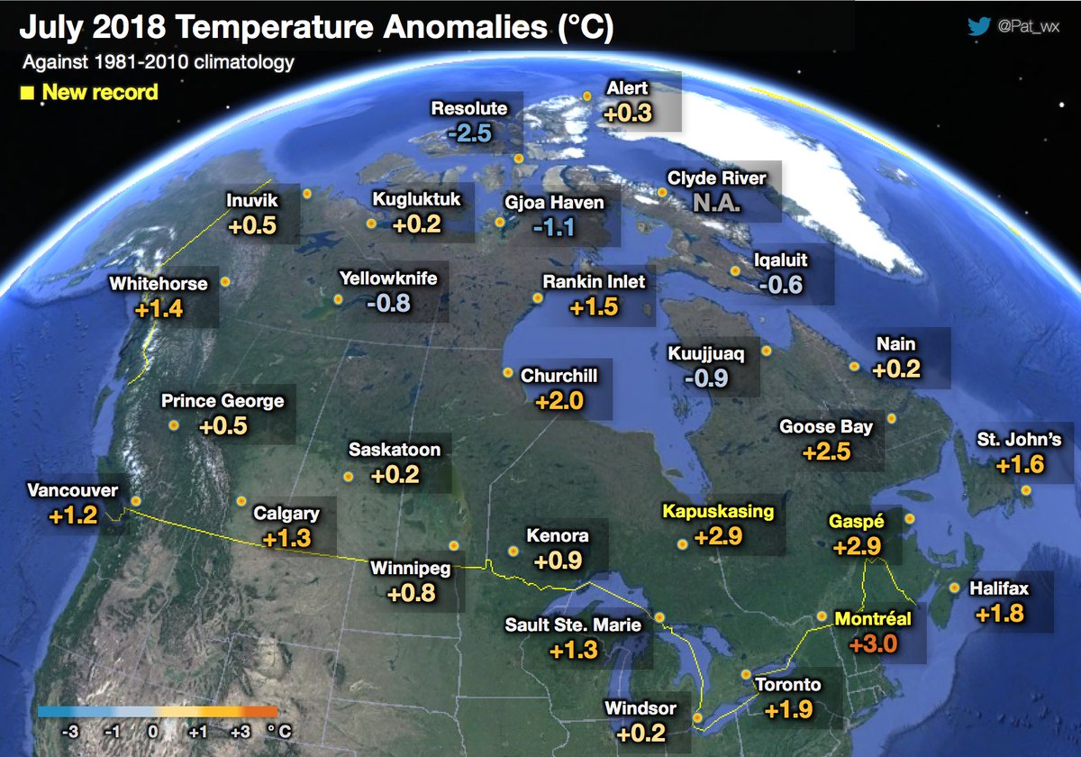
Here is some July 2018 climatology:
 NWS Los AngelesVerified account @NWSLosAngeles

California Climate Tracker: https://wrcc.dri.edu/monitor/cal-mon/ …
 NWS RenoVerified account @NWSReno


(If you like these posts and my work please contribute via the PayPal widget, which has recently been added to this site. Thanks in advance for any support.)
The Weather Channel