Saturday April 7th… Dear Diary. The main purpose of this ongoing post will be to track United States extreme or record temperatures related to climate change. Any reports I see of ETs will be listed below the main topic of the day. I’ll refer to extreme or record temperatures as ETs (not extraterrestrials)😊. Here is today’s main climate change related topic:
Climate Change and a Spring Storm
Segueing from yesterday’s post in which I’ve stated that all weather and current climate change are linked, I’ve noticed that met models have keyed in on and are very consistent with a strong storm that should plow through the nation next week. Now, a strong storm system moving through the U.S. this time of the year isn’t that uncommon, but this one looks particularly potent. Here is the forecast Northern Hemisphere 500 millibar setup:
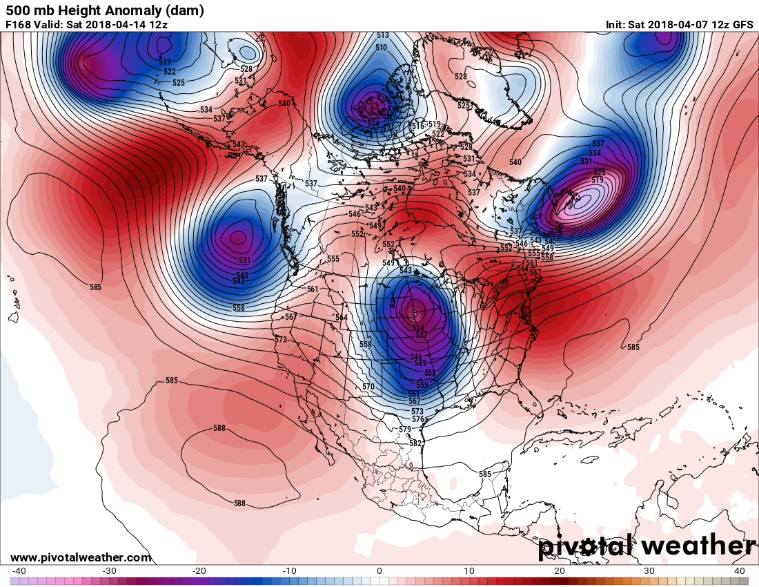
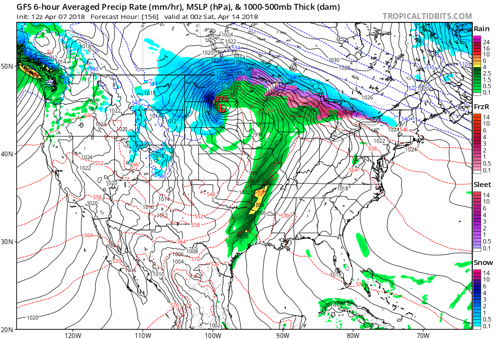
A week from today the strong system will be over the nation’s heartland producing a blizzard in the northern Plains and thunderstorms in the central and southern Plains. It’s way too early to predict if the system will produce a lot of tornadic activity, though. What’s striking on the Pivotal chart are the, count them, six closed lows. It’s as if warmth, as indicated by the red anomalous heights, will be squeezing and pressing on the polar vortex breaking it up into six swirling systems, one of which will be moving eastward trough the U.S. We’ll see if this morning’s GFS resembles this pattern at the surface:
What I’m essentially getting at today is that counterintuitively warmth aloft produced by the imbalance of radiation from carbon pollution is aiding in the formation of smaller cold pockets, or closed lows, as opposed to one large cold pocket over the North Pole with several smaller appendages rotating through mid-latitudes about the parent vortex. The Arctic warmth might be forcing the closed lows further south and to be tighter; thus stronger, than say several decades ago with the same long wave setup. Next Saturday might be another case.
I’ll emphasize that this is all “educated conjecture” that has been imprinted on my memory after looking at met charts for 30+ years. Researchers like Daniel Swain will eventually dot the Is and cross the Ts here.
………………………………………………………………………………………………………………………………………………………
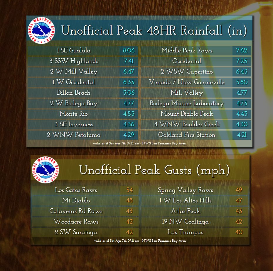
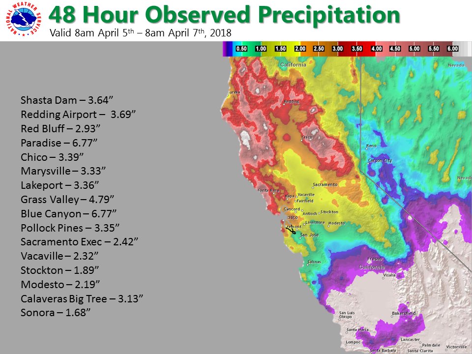
Here are some rainfall totals from yesterday’s “atmospheric river” episode in northern and central California:
 NWS Bay AreaVerified account @NWSBayArea
 NWS SacramentoVerified account @NWSSacramento
Valley: 1.5-3.75″
Foothills: 2 – 5+”
Mountains: 3 – 7″
Detailed list of reports: https://nwschat.weather.gov/p.php?pid=201804071529-KSTO-NOUS46-PNSSTO … #cawx
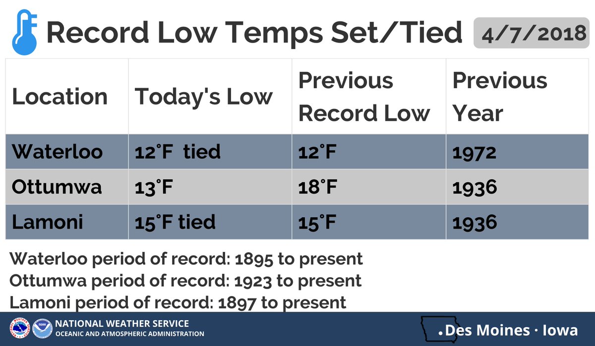
I may add more ETs in this space later today knowing that many cold records were set this morning in the Midwest. Here is what I have seen, so far:

It was another cold morning across Iowa with record lows set or tied at Waterloo, Ottumwa and Lamoni #iawx
(If you like these posts and my work please contribute via the PayPal widget, which has recently been added to this site. Thanks in advance for any support.)
The Climate Guy