Nate and a front has put a dent in the thing, but it just won’t die. Just how long will anomalously warm temperatures last across the eastern U.S? The heat dome will build up to historical levels again across the eastern U.S. this week. Nate can be seen on 500 mb charts as a little divot in Alabama on the periphery of the dome here:

The ridge, or heat dome, has actually progressed into the Atlantic looking at the 591 dm contour in the chart. In order to read the chart and find out the relationship between heat domes and climate change please read this prior post:
https://guyonclimate.com/2017/10/02/dissecting-the-heat-dome/
By the end of this week we see a sprawling dome above 588 decameters stretching from Texas through the Midwest to New York City, which looks mid-summerish, not what a meteorologist would expect in mid-October. More 500 mb “height” records for October should be set. Should this chart verify, once again, I’ll be stating that I’ve never seen a ridge this strong so late into the fall season:
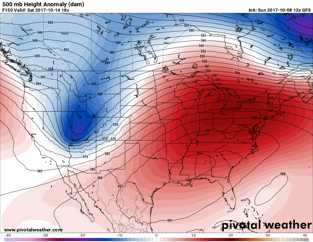
I have high confidence in this thing verifying looking at ensemble models:

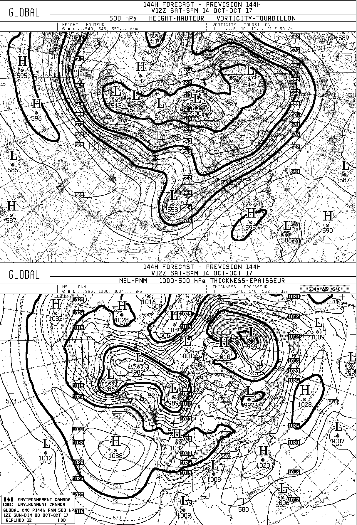
The brown circles on the left panel in the Southeast represent individual ensemble members forecasting a 594+ decameter ridge… historically high heights for mid-October.
What’s that little black circle on the right panel near the Bahamas? This would be relatively low heights, or cold air aloft, from an old frontal trough extending out into the central Atlantic. Sometimes these systems can get some spin, quickly becoming tropical in nature during the summer. Well, we have a summertime weather pattern, don’t we. The Canadian Model, which is one of the least reliable tropical models but can pick up on trends, does develop this system near Florida:
So will something develop like Nate or worse late this week? We’ll see if our tropical troubles from a woeful season continue from what I’ll contend is a ramped up, souped up, carbon pollution amped up atmosphere. Add a dash of a very little upper shear pattern over the Atlantic Basin to that soup, and you get the 2017 hurricane season.
I’ll be reporting on any tropical development as wells as records from this warm pattern this week.
The Climate Guy